
Partners in the SESAR AUDIO (Airspace User supporting Demonstration of Integrated Airport Operations) demonstration are developing a moving map display for pilots to increase their situational awareness while the aircraft is taxiing. To ensure the design of the map fits the needs of the end users, the project organised a session with Lufthansa pilots on 11 February.
On time, resilient and seamless traffic in European airspace requires a modernised air transport system. has been launched. The demonstration project, funded by the European Union, aims to improve safety, efficiency and predictability of flights by increasing the flight crew's situational awareness while the aircraft is taxiing.
In the next 20 years, the frequency of air travel for the average citizen will increase by one to two percent per year in developed countries, according to a recent IATA forecast. This means new challenges for airports and pilots, who will have to manage increased congestion whilst maintaining safety.
A “connected” moving map means adding real time traffic information and taxi route to the existing airport moving map application in the electronic flight bag. Airports providing this local data to the pilots would further support flight crews in navigating safely and efficiently on the ground. This capability builds on solutions developed in SESAR 1.
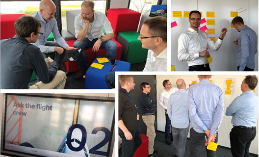
Participants started the workshop by mapping the taxi in and taxi out procedures and the critical steps which could benefit from the additional data in a visual display. The pilots could imagine some advantages, such as being able to adjust taxi speed and power settings based on the traffic situation, or with a more predictable taxi route, using Single Engine Taxi procedures more often. They brainstormed on what visual display elements are useful in other routing applications, and with this in mind, each pilot designed their ideal display of real time traffic situation and routing. Then, they voted on the best design ideas, identifying which could be the most useful to implement. This exercise helped the AUDIO partners to really understand pilots’ needs in order to design a well-adapted display. Pilots made it clear that having this connected moving map would help them anticipate, making ground movements easier.
Four experienced european partners join forces in AUDIO
AUDIO is coordinated by DLR, which provides ground information, flight plan and route information collected by the Airport Research and Innovation platform (ARIF) in Hamburg, Germany. Deutsche Lufthansa will adapt the existing EFB solutions, oversee the demonstration at Hamburg Airport and evaluate them under real-life conditions and coordinate with safety authorities, including EASA. Norway-based SINTEF provides the SESAR solutions to be used for the demonstration. French management consultancy ARTTIC will ensure the dissemination of the project's results and achievements.
AUDIO is funded under the SESAR 2020 programme through a specific call within the European Union's Horizon 2020 framework programme for Research & Innovation, specifically aiming to modernize the air traffic management system. A total of 1.06 million Euros has been awarded to the consortium to run the project over two years