Accurate altitude measurement is a critical challenge in Air Traffic Management (ATM), where even small errors can affect safety and efficiency. John Godsell, NATS, is leading work in the Green-GEAR that is exploring the transition from barometric to geometric altimetry. In this interview he explains how the project is addressing the transition to improve airspace management for a safer, more sustainable aviation future.
Leading Work Package 3: Assessing the Feasibility of a Network-Wide Switch from Barometric to Geometric Altimetry - GeoAlt
Mr Godsell, could you explain how barometric altimetry works and its limitations?
Since the early days of aviation, barometric altimetry has been the primary method for determining an aircraft’s altitude. It works by measuring the difference between atmospheric pressure at the aircraft’s current position and a standardised sea-level pressure. This system is based on the principle that atmospheric pressure decreases predictably with increasing altitude.
However, in real-world conditions, atmospheric pressure can fluctuate due to changing weather systems, temperature gradients, and local variations, leading to deviations from the International Standard Atmosphere (ISA) model. To account for these variations, pilots must periodically adjust their altimeters to reflect either local pressure (QNH) or the standard pressure setting (1013.25 hPa). These adjustments are particularly important when crossing the transition layer on descent and on climb, which marks the boundary between using local and standard pressure settings.

fig.1 sample plot of geometric altitude (blue line) measured onboard an aircraft flying at constant barometric altitude (green line)
While aviation is already extraordinarily safe, even minor errors in these manual adjustments can result in altitude discrepancies. These might affect terrain clearance or vertical separation between aircraft. To mitigate this, strict safety buffers are maintained, but these constraints also limit airspace capacity and reduce the flexibility of Air Traffic Management (ATM) to optimise fuel-efficient approach and descent trajectories, especially in the busy Terminal Manoeuvring Area (TMA).
How could geometric altimetry address these challenges?
Geometric altimetry offers the potential to enhance safety even further by providing more accurate and consistent altitude data based on satellite navigation rather than atmospheric pressure. This consistency reduces the risk of altitude deviations caused by pressure fluctuations or manual setting errors, enabling tighter vertical separation between aircraft while maintaining high safety standards.
Moreover, geometric altimetry simplifies flight procedures by eliminating the need for manual pressure adjustments and the transition between local and standard pressure settings. This reduces pilot workload and the chance of error during critical phases like approach and descent. With reliable, real-time altitude data, Air Traffic Management could plan and implement more efficient flight paths, improving airspace capacity and supporting the industry’s sustainability goals without compromising safety.
What is NATS’ role within the Green-GEAR project, and what are you currently working on?
NATS is working alongside Airbus and DLR to develop and evaluate a solution called GeoAlt. Our team is currently focused on three parallel assessment activities.
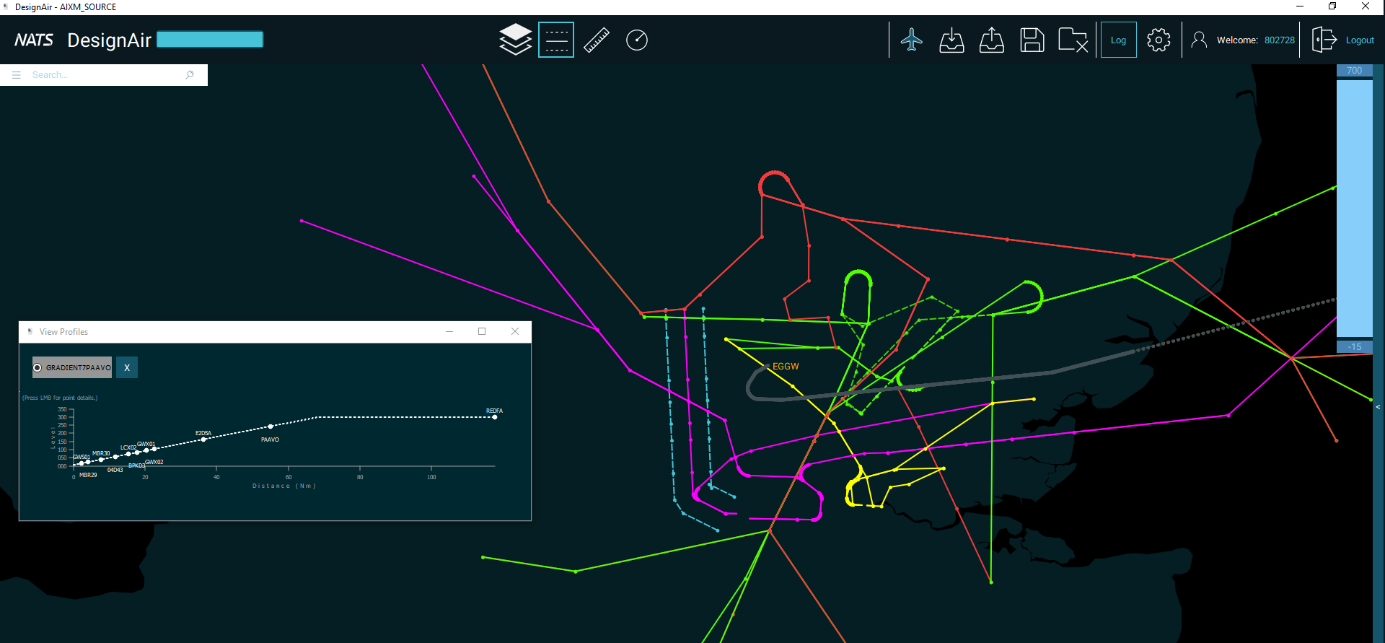
First, we’ve developed two test-case airspace models for the London TMA: one optimised for Barometric Altimetry (BaroAlt) and the other for Geometric Altimetry (GeoAlt). We have begun Fast-Time Simulations using traffic scenarios projected for 2035 to compare their performance.

Figure 1 - NATS DesignAir tool
Second, these TMA procedures have been shared with DLR, which is analysing their effectiveness from the perspective of individual aircraft. Using their Airbus A320 model, DLR is also comparing BaroAlt and GeoAlt systems in cruise flight.
Finally, Airbus is assessing the impact of GeoAlt on aircraft systems, focusing on key areas such as navigation and flight management to ensure compatibility with current and future technologies.
If Green-GEAR’s solutions demonstrate clear benefits, what steps would follow?
Green-GEAR is part of the EU’s Exploratory Research programme and aims to reach Technology Readiness Level 2 (TRL2). At this stage, our focus is on observing and validating the fundamental principles of the GeoAlt concept through experimental research.
If the results show significant potential, the next step would involve advancing these concepts through Industrial Research, primarily focusing on further developing aircraft systems to fully integrate geometric altimetry. This progression would bring us closer to widespread adoption, unlocking its full potential to enhance safety, efficiency, and sustainability across the aviation sector.
The project is co-funded within the framework of Horizon Europe and brings together the following organisations: Deutsches Zentrum für Luft- und Raumfahrt, Airbus, Airbus Operations , Eurocontrol, Universita degli Studi Di Trieste, Stichting Koninklijk Nederlands Lucht - En Ruimtevaartcentrum, NATS, University of Westminster
More about the project
